Seeing the Patterns: How Spatial Analysis Reveals Hidden Stories in Conflict Zones

Have you ever wondered why certain types of conflict seem to cluster in specific regions — or why some areas remain peaceful?
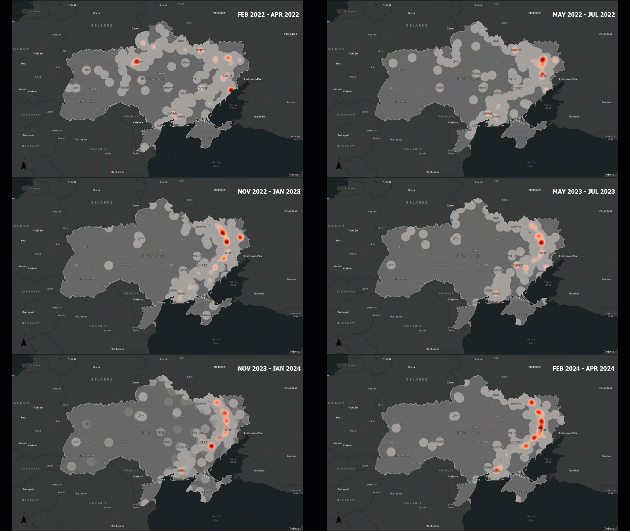
Timelapse of conflict hotspots in Ukraine for three month periods from February 2022 to April 2024. Julia Huber. From Escalation to Exodus: Mapping the Evolution and Human Toll of the Russia-Ukraine War

Traditional analysis might count how many incidents occur. Spatial analysis lets us see how those incidents are arranged — are they clustered around borders, along roads, or near population centers?

For example, in a conflict zone, we might find that attacks cluster along major highways or near disputed boundaries. This pattern tells us something about accessibility, control, or strategic importance — insights that are invisible in non-spatial data.

Here is where spatial analysis plays a huge role.

Continue reading

Introduction to GIS Data: Choosing, Understanding, and Using It Responsibly

Choosing the Right Layers in GIS

When you’re first exploring a data portal, it can be tempting to download and add every layer you see. After all, more data feels like more power, right? But in GIS, adding too much information can quickly lead to cluttered maps, longer processing times, and even misleading results.

Continue reading