Seeing the Patterns: How Spatial Analysis Reveals Hidden Stories in Conflict Zones

Have you ever wondered why certain types of conflict seem to cluster in specific regions — or why some areas remain peaceful?
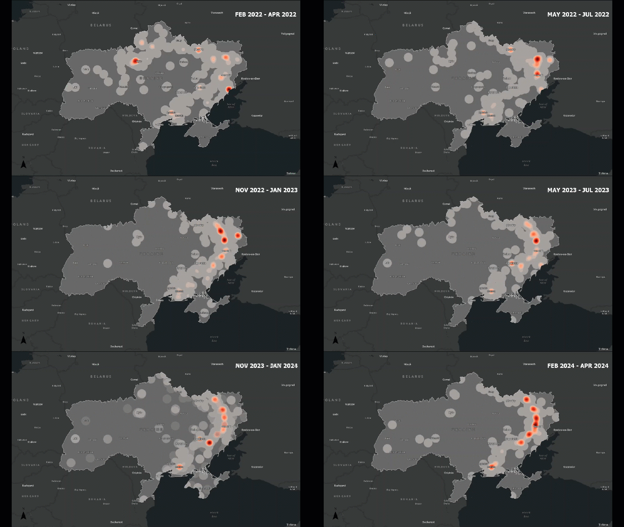
Timelapse of conflict hotspots in Ukraine for three month periods from February 2022 to April 2024. Julia Huber. From Escalation to Exodus: Mapping the Evolution and Human Toll of the Russia-Ukraine War

Traditional analysis might count how many incidents occur. Spatial analysis lets us see how those incidents are arranged — are they clustered around borders, along roads, or near population centers?

For example, in a conflict zone, we might find that attacks cluster along major highways or near disputed boundaries. This pattern tells us something about accessibility, control, or strategic importance — insights that are invisible in non-spatial data.

Here is where spatial analysis plays a huge role.

Continue reading

The Fundamentals of Coordinate Systems

Coordinate systems and map projections are super important because they help us accurately represent locations on Earth, align data from different sources, and minimize distortions when we create flat maps from a round planet. Without a consistent coordinate system, like latitude and longitude, we wouldn’t be able to pinpoint locations or analyze spatial data properly. Projections help us handle the tricky task of flattening the Earth by letting us control how things like shape, distance, and direction are distorted. This is key for everything from navigating and measuring distances to creating visually accurate maps. In short, they ensure that our maps and data make sense and work correctly across different applications.

Continue reading

Cartographic Principles, Classification and Symbology

Cartography is the art and science of making maps, and in the context of geographic information systems (GIS) it is a critical step in turning data into information people can actually use. Maps are not just pictures of geography—they are carefully designed tools that help us navigate, see patterns, understand relationships, and share knowledge about the world around us.

A map’s effectiveness comes not only from the data behind it, but also from how its elements are designed and organized. Titles, legends, scale bars, symbols, and the map body all play a role in communication—but whether they succeed depends on applying solid cartographic principles.

In this post, we’ll first walk through six of the most important cartographic principles that every mapmaker (and GIS user) should consider when designing a map. We’ll then move into classification methods and symbology, which are essential for turning data into clear and meaningful visual stories.

Continue reading